The plan for Friday was to check out of the B&B early and begin to head east back towards Beauvais, taking the coast road along the Calvados coastline, hitting Omaha, Gold, June and Sword Beaches, along with other points of interest on the way.
This portion of the trip was intruiging to me, because unlike the Cotentin peninsula area north and west of Carentan, which had been the base of the US airborne operations, I knew very little about the action that occured along Calvados. Moving west to east, the beaches were designated as Omaha (US 1st and 29th Infantry Divisions), Gold (British 50th Infantry Division), Juno (Canadian 3rd Infantry Division) and Sword (British 3rd Infantry Division). On the left (eastern) flank of the invasion, the British 6th Airborne Division was dropped in and tasked with protecting the invasion's flank, as well as capturing key bridges in the area.
My first stop was Pointe-du-Hoc, just east of the town of Grandcamp Maisy. Pointe-du-Hoc is a rocky outcropping that was the site of a large gun battery, capable of raining fire down on both Omaha and Utah beaches. Though the site had been heavily bombarded in the days and weeks leading up to D-Day, it was not destroyed, so the task of neutralizing the guns fell to the men of the 2nd Rangers battalion.
Equipped with specialized climbing equipment, the Rangers managed to scale the sheer cliffs from the sea and captured the site--only to find out that the five 155mm guns which were there objective, had been previously moved inland to a different location. Resistance had been strong, nonetheless and casualties were high.
The most striking thing about the Pointe-du-Hoc site is that unlike the other sites, where farmers were eager to regain use of their fields after the war, the terrain at Pointe-du-Hoc has been left more or less as it was, which is to say, so pockmarked with bomb craters that it has an eerie, lunar feel:
Pointe-du-Hoc
I had planned to hit the Rangers Museum near Pointe-du-Hoc, but apparently the museum is in the town of Grandcamp Maisy, and I somehow missed it while passing through. Nonetheless, the site at Pointe-du-Hoc was incredible, and is an absolute must-see for anyone interested in visiting the D-Day area. The beautifully scenic views of the coastline offered from the point strike a hard contrast with the brutal ruins of concrete tumbling in the countless craters covering the expansive site.
From Pointe-du-Hoc, I continued on into the town of Vierville-sur-Mer, at the western end of Omaha Beach.
In general, I was surprised at the contrast between Utah and Omaha, not only in terms of terrain, but also level of development. Utah was a gently sloping beach with short, grassy dunes at the top. Inland from the top of the dunes, stretched a low, flat expanse of quiet, sleepy farmland that feels as though its been perfectly preserved in time. Were it not for its historic significance, it seems few folks other than local farmers would visit the area.
Omaha Beach, and the entire Calvados coast (the west-to-east coastline that encompasses Omaha, Gold, Juno and Sword beaches) for that matter, has much more of a resort/beach town feel to it. Many such towns stretch across the entire coastline area. Omaha Beach itself has a nicely landscaped, paved road right along the top of the beachhead, with a string of vacation homes, restaurants and guesthouses lining the opposite side of it. Behind the road and the beach homes are tall, scruffy bluffs that made for a formidable defense. It's not surprising, therefore, that the assault on Omaha was much more brutal, and took much longer, than the one at Utah. Atop the bluffs, the region is still farmland, but it is more nicely manicured cropland, whereas the Cotentin region behind Utah seemed to focus on livestock pastures and had a much more rustic feel.
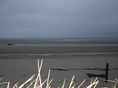
 Omaha Beach
Near the center of the 3.5 mile beach stands a monument, and a sculpture, entitled
Les Braves.
 Les Braves
At this site, there was a plaza with a series of flagpoles, and as I was there, a ceremony of some sort was going on. I didn't quite get what the ceremony was about, but I did manage to catch some video of what was one of the most poignant and emotional moments of the trip:
After the ceremony, I headed to the D-Day Memorial Museum which was right up the road a few hundred yards. It was nice, though smaller than the Utah Beach museum. There are at least two or three D-Day Museums in the Omaha Beach area alone, though, and this was the only one I got the chance to visit.
I'm now going to jump out of order for a moment.
The next spot that I visited was the American Military
Cemetery at
Colleville-
sur-
Mer, overlooking Omaha Beach. But I'm going to save those thoughts and pictures for a fitting end to this post.
The next site moving east was the third and final gun battery location that I visited, near
Longues-
sur-
Mer. This battery sits in a wheat field high on the edge of a cliff, overlooking the English channel between Omaha and Gold Beaches. It is the only battery in Normandy to still have its original gun turrets in place.
 One of the gun emplacements at Longues-sur-Mer
Looking east from
Longues-
sur-
Mer, one could see the remains of the 'Mulberry' artificial harbor that was built off the town of
Arromanches at the western end of Gold Beach:

Down the road from
Longues-
sur-
Mer, I stopped off on the cliff hanging over the eastern end of
Arromanches, where there is a cinema presentation called
Arromanches360. It's a 15 minute-or-so film presented on 9 screens in the round, which brings together vintage film from WWII, along with scenes of Normandy in the modern day, many of which were filmed in the round, from helicopters, ships, and people walking through streets. It's presented without words and is a very moving (emotionally and at times, physically). Very cool and another site I would highly recommend for anyone touring the area.
From the cliff outside the theatre, you have a beautiful view overlooking the town of
Arromanches, which seems that it would be a fantastic place to stay if someone were looking for a more traditional vacation getaway:

Unfortunately, by this point, I was running short on time and did not have a chance to explore the town in detail, though it looked lovely.
Starting to crunch for time, I was frantically calculating how much time I was going to need to get back to the airport. I'm notorious for giving myself far more time than I need (generally a good plan, I feel), but in this case, I knew that doing so would cheat me out of seeing one or two more things that I might regret missing later. After quick deliberation, I decided I could still squeeze in a quick visit to the Juno Beach Centre in
Courseulles-
sur-
Mer.
 After all, how many places in the world outside of the Great White North and various Olympic Ice Hockey venues do you get to see Canada take center stage?
I talked a bit about my stop at the Juno Beach Centre
previously, and it was definitely one of my favorites of all the museums I visited. Like I said, it was the
only museum in Normandy to feature a curling stone:

After my brief stop at Juno Beach, I quickly began to make my way back towards
Beauvais. Unfortunately, I had to skip past Sword Beach at that point, and did not get to visit any of the British-oriented museums. My route (aimed to not only maximize my sights along the
Calvados Coast, but also to circumvent
Caen and any traffic problems I might have run into there) took me through the towns of
Benouville and
Ranville and past
Pegasus Bridge, which was a major objective of the British 6
th Airborne during the invasion, but by then, I definitely did not have time to stop. Back on the A13 tollway shortly after that, I was cruising my way back to
Beauvais.
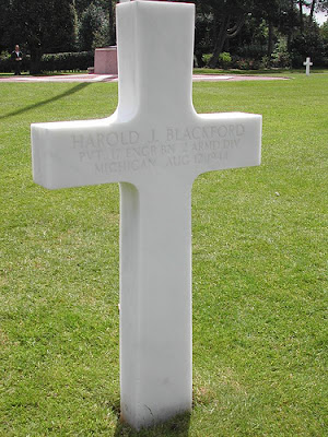
I'm going to wrap this post up now with some final thoughts and photos from the American Military
Cemetery overlooking Omaha Beach at
Colleville-
sur-
Mer. The
cemetery has all the appropriate grace and dignity that the men who rest there deserve. It is beautifully laid out, and the absolute precision with which the crosses are aligned in every direction, make the
cemetery itself a work of art, fittingly memorial. From nearly any point among the markers, lines seem to radiate in every direction as the crosses and gaps between them line up along such perfect edges, as though the spirits of the men who lie there--and of freedom itself--are radiating out from that very spot.



For the rest of my pictures, please see the following links:


